Monday, May 21, 2012

S'mores Island, North Carolina

Chef Bolen at work.
Sunset
Taken from my sleeping bag on the beach at sunrise

Ralph and Maggie

Monday, April 23, 2012

Appalachian trail: Damascus to Wilbur Dam Road


Starting Point: Damascus, VA
Ending Point: Wilbur Dam Road, TN
Distance: 38 Miles one way (plus a couple miles of road walking)
Break Down: Day 1--15 miles to campsite just south of 421
                       Day 2--11 miles to Iron Mt. Shelter
                       Day 3-- 12 Miles to Wilbur Dam Rd      
Date: April 20-22, 2012
Trip highlights: Damascus is a great place for hikers, easy grade, Nick Grindstaff monument, Views of Holston Lake and Lake Watagua, Views from Old Osborne Farm.
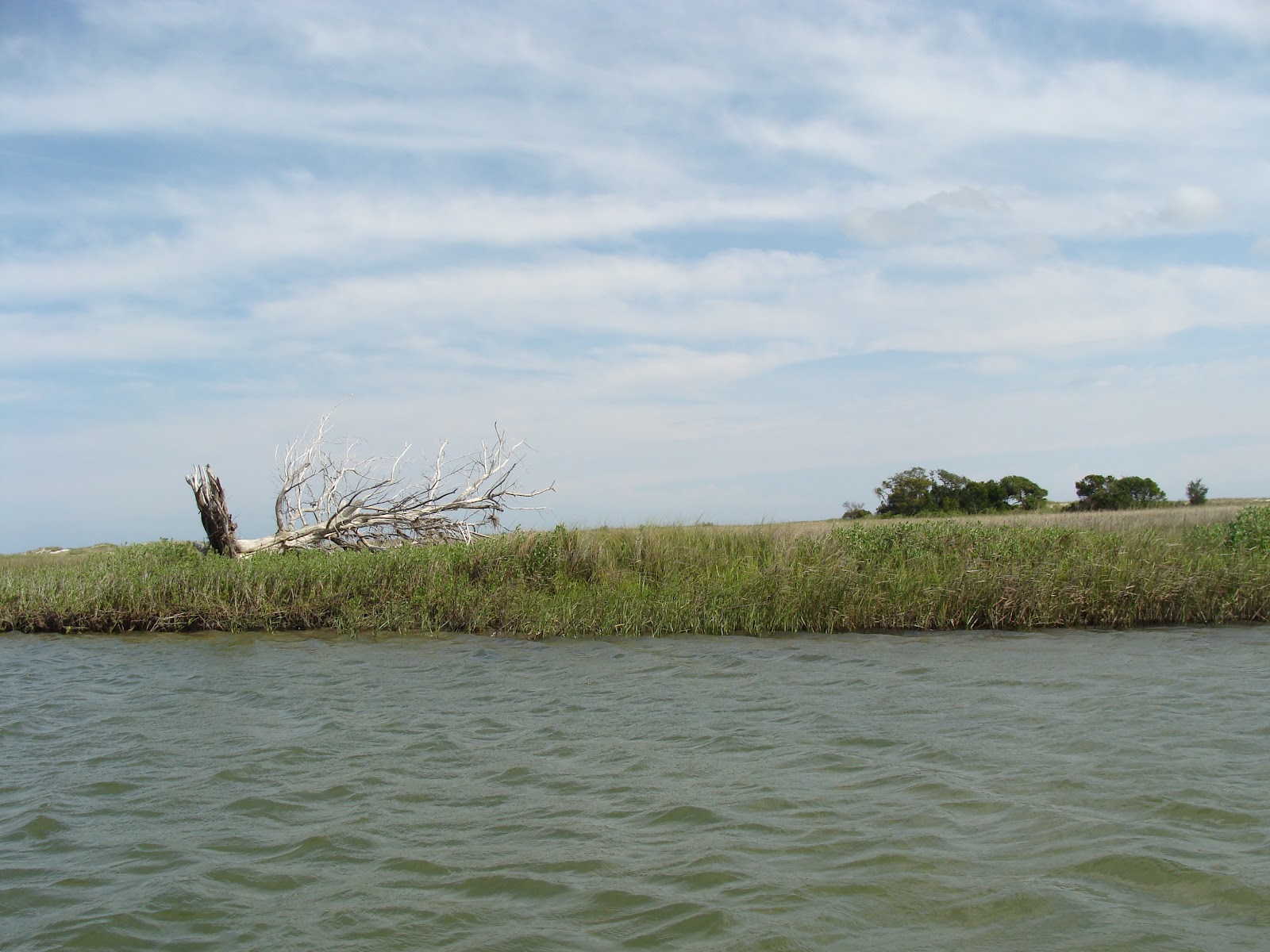
Osborne Farm


Jon, Ashley, and I had been planning a 30 mile hike on the Art Loeb Trail in Pisgah National Forest for a couple of months.   When one third of our party had to back out (owning a business requires responsibility) and the weatherman started talking about thunderstorms; Jon and I decided to reconsider the trip.

After work on Thursday night we met at Jon's house to consider new plans. We weren't opposed to hiking in thunderstorms, but Art Loeb's 6000+ foot open ridgelines didn't seem like the best place to endure one.  We considered a loop in Shining Rock but decided against a four hour drive for a rainy hike.  We looked at the Falls Lake section of the Mountains to Sea Trail and at a couple state parks West of Charlotte but nothing seemed to wet our hiker's appetite.  At around midnight I finally came to the conclusion that we take a two and a half hour drive to Damascus and just kind of wing it.

At 8:00 the next morning I was back at Jon's to pick him up.  After gassing up the car and scouring the earth for a cup o'joe (State Street why you no have coffee??), we hit the highway by 8:30.  We arrived in Down Town Damascus exactly three hours later, which was fairly good time after the traffic in Boone and our not-so-quick stop at Espresso News

We went into Mount Rogers Outfitters to see if they recommended  any particular hikes.  The Guy behind the counter (who, in the 15 minutes we interacted with him, consumed a quite impressive number of bananas) had several suggestions--Fox Creek, Iron Mountain Loop, Grayson Highlands--but after looking at a couple maps, we decided to just head south on the Appalachian Trail and keep going with the "winging it" mentality.  Our friend Nick said he might be able to meet us on the trail on Saturday so we confirmed with Banana Man that the parking lot on 91 was a good spot for overnight parking.

Eager to hit the trail, we grabbed a quick bit to eat at Cowboy's, registered our car for overnight parking at Town Hall and started south.

The trail goes right through the middle of town, crosses a park, then heads into the woods behind a neighborhood.  The trail picks up about 1500 feet in the first three miles, making the start of this hike a bit of a work out but not a spirit-breaker.  In a little over an hour we came to the Tennessee/Virginia Border.  Despite our afternoon start, we were moving faster than three miles per hour and were making pretty good time.

The trail continues to gain elevation for another mile or so but then gently levels out.  We reached the Backbone Rock Trail and decided to fill up our water bottles.  The map indicated that there was a water source but two day-hikers told us that it was 3 miles down to the creek so we decided to trek on to the next source.

  After passing through a nice stent of Hemlocks, we came to Abingdon Gap Shelter.  We chatted with a few thru-hikers and took advantage of the shelter's water source but kept our break short.

Several rock structures, old foundations and an old demolished fire tower line the trail for the next several miles.  We headed on towards 421 and decided to camp at the first campsite south of the highway.  We ate dinner, hang our food, and went to bed fairly early.  A hoot owl carried on all night just out side of our tent.

Jon's cell phone had service near 421 so we tried to contact Nick.  We had no luck and after several attempts we concluded that he must not have been able to meet us after all.  This left us with the dilemma of whether to hike back to Damascus or to try and hitchhike from one of several road crossings.  We packed up camp and decided to keep heading south and either hitchhike from 91 or from Watagua Dam.

South of 421 the  trail leads through a wooded ridgeline that offers some good views, including views to the west of Holston Lake.  There were a couple of good campsites along the trail  before reaching Double Springs Shelter.  The shelter has a good water source right on the trail.  The sky had been cloudy all morning, but when we reached the shelter it looked like it could start pouring and minute.  We put on our rain gear and pack covers and kept hiking.
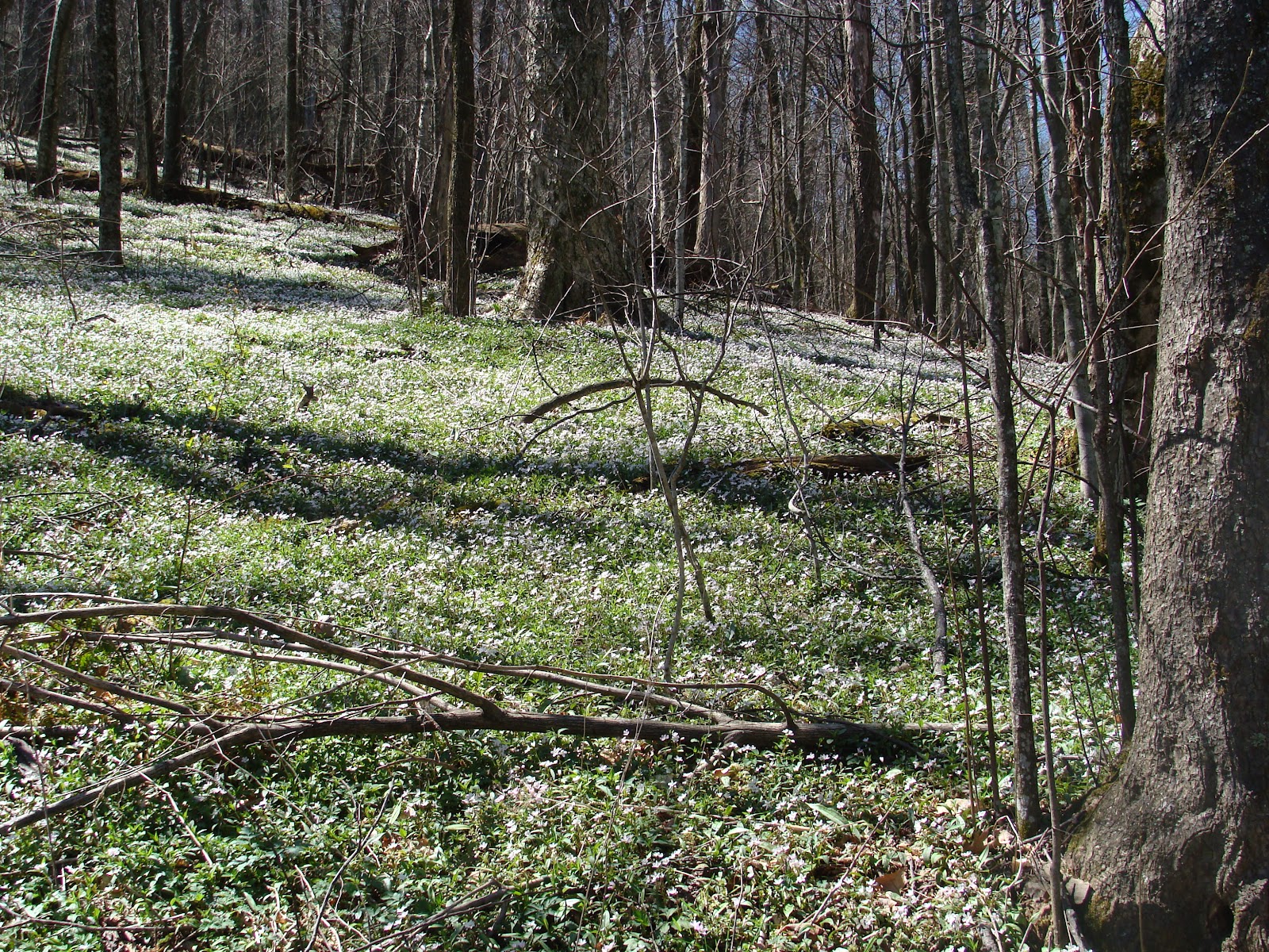
View from ridge south of 421


A couple miles past the shelter, the trail comes to the Old Osborne Farm.  The sky, which could not make up its mind, decided to clear up right before we reached the farm.  This allowed for great views of the farmland and surrounding mountains.  The meadow had one bull grazing and several old buildings and fences.   The trail passes through the farm for close to a mile until you reach 91.


We came to the parking lot on 91 and decided to try calling Nick one more time.  He didn't answer so we ate a quick snack and moved on.  About a hundred yards past the highway, a church had left a cooler full of soda and Little Debbies.  we enjoyed a little trail magic then kept on going.  Not 50 yards further we came to a couple guys listening to the radio and sitting under a large blue tarp.  They offered us a cold beer and told us to tell other hikers on the trail to stop by for a beer and a burger.

They had thru-hiked in 1997 and had soon afterward moved to Damascus.  We swapped trail stories for a few minutes then headed down the trail, telling passing NOBO hikers about the trail magic ahead. 

three and a half miles on, we came to the grave of Nick GrindStaff, a hermit that lived on Iron Mountain until his death in 1923.  A water source is located on a spur trail near the monument.

About a mile past the grave we came to Iron Mountain Shelter.  We set up our hammocks and ate lunch while lounging around.  when we heard thunder, we took down our hammocks and went into the shelter.  Several hikers came through to eat lunch but most moved on, anxious to get closer to Damascus.  Although it wasn't quite 3:00, we decided to stay at the shelter as opposed to moving on and call it an eleven mile day.  A thru-hiker named Column was in the shelter recovering from a stomach bug and another hiker from Florida tent camped outside the shelter.  Column was in the ER 2 nights before and hadn't taken a zero day.  He was having trouble keeping food down so we offered him Coconut powder and tea. 

Jon and I looked at the map and debated returning to 91 in the morning or pressing on to Watagua Dam.  by the time we went to bed we were pretty set on making it to the dam.

We woke up early to a fogy morning and, after coffee, breakfast, and wishing Column good luck, we were on the trail by 7:30.  We made it 7 miles to Vandeventer Shelter at a little after 10.  We stopped for a snack and some more coffee.  Behind the shelter would have been one of the most impressive views along this section of trail, but all we could see was fog.  I can only imagine how impressive a sunrise from the rocks behind the shelter would be. 

The fog began to lift at we hiked on past the shelter.  Pretty soon we began to catch glimpses of Watagua Lake.  A couple of quick elevation gains keep this section interesting, but its mostly down hill from the shelter. We stopped  for a few minutes at a overlook off the trail and were impressed with the views of the lake and surrounding ridges.  several Thru-hikers and a couple ridge-runners past us.  We started back on the trail and soon came to nice grove of pine forests which offered a nice change in scenery.

Five miles past Vandeventer Shelter we Came to Wilbur road.  We decided we better start thinking about how to get back to Damascus, so we figured we should try to hitch a ride from there and If we had no luck continue four miles to Watagua Dam and try to hitch from 321.  It wasn't yet 1:00 so we had a lot of daylight to work with.

Several Cars passed with no luck.  a minivan carrying three generations stopped but they were heading in the opposite direction.  They offered us cheese and cracker, which was much appreciated.  We were about to give up and head to 321 When two ETSU students, Lenny and Christian, Offered us a ride into Hapton--where they said we would have better luck getting picked up.

We accepted the ride and headed to Hampton.  After interesting conversation ranging in topic from hiking to HAM radios, they dropped us off at the trail head of Laurel Trail on 67.  After about an hour, a guy in a pick up on his way to Mt. City, TN stopped and offered us a ride.  He dropped us of at a Rite Aid a quarter mile from 91.  We started walking towards 91 and then headed north on the highway.  We walked about two miles beside the highway before a man named Raleigh picked us up.

Raleigh was on his way to a town just passed Damascus to help a friend whose transition had died.  He grew up in Winston Salem, NC and had some great stories to tell about everything from big foot to gold mining to  dogs getting stuck in attics.

He dropped us off in Damascus and it hit us how great a weekend we had had.  We stopped at Quincey's Pizza in Damascus, which was filled with hikers.  The hiker who camped outside of the shelter last night and another hiker we had met on the trail named Calves were eating at the bar so we joined them.  A German couple that we had talked to on the trail the day before came in soon after.  The pizza was great I recommend the Philly Cheese-Steak Pie. 

After some catching up with fellow hikers, we headed back to Greensboro.  We agreed that winging it from Damascus is an occurrence that we will experience again in the future. It really is a great town for hikers.

Oh yeah, I haven't forgotten about you Art Loeb.  We will meet soon, on a day of my own choosing when you least expect it--and you will be conquered. 


Thursday, March 29, 2012

Great Smoky Mountains Mt. Cammerer Loop

Starting Point: Cosby Camp Ground, TN
Distance: 40 Miles
Break Down: Day 1--11.7 miles to campsite 29
                       Day 2--17 Miles to Davenport Gap
                       Day 3-- 11.3 roundMiles to Cosby Camp                    
Date: March 26-28, 2012
Trip highlights: The chance to experience a variety of scenery in one trip--including pine forests, dense virgin hardwood forests, waterfalls, creek crossings, miles of ridge line views, a peak with a fire tower and a bald Mountain.  Also, this trip offers many opportunities to either be extended or shortened so you can really hike your own hike. 

After filling our a slip at the registration office, I threw on my pack and headed to the Gabe's Mountain trailhead.

The trail starts with a gradual climb to Hen Hollow Falls, a popular destination for tourists and day hikers.  2.2 miles in there is a short side trail to the bottom of the falls.  The waterfall was definitely worth the short (but steep) side trip.  The rocks at the bottom are slippery but there's plenty of dry boulders on which to climb or just sit and enjoy a snack. 

After soaking in the the view from Hen Hollow, I started back up Gabe's Mountain Trail.  After the Falls, the trail climbs steeply and heads into a lush green Forrest.  I didn't see any more hikers that day, until I got to the campsite, so the rest of Gabe's Mountain Trail offered a great sense of solitude and really gave the remote feeling of being in the middle of the woods.

Campsite 34 is a couple miles past the falls.   It was nestled next to a creek and offered room for several tents and had bear cables.  There was one tent at the site, but I did not see any hikers.

Before intersecting with Maddron Bald Trail, Gabe's Mountain winds through pine forests, over creeks and through mountain coves.  The floor of the coves were covered in clover and blooming flowers--making everything look increasingly green.  I am pretty sure this is where leprechauns come from--Actually I'm sure of it.
 After almost 7 miles, the trail opens up to a gravel intersection.  two benches offered a great spot to stop for lunch.  I kept my break short, though, because I wanted to get to camp with plenty of daylight.  I started down Maddron Bald Trail towards Snake Den Ridge.

The first mile or so of trail was disappointingly a wide gravel road that offered little scenery.  After that, however, the trail acceded thought dense hardwoods and early spring blossoms.  1.7 miles in, the trail splits, offering a chance to take the .7 mile Albright Grove Loop.  I took the loop which lead me on a quick stint through old-growth forest, ancient giant trees, and blooming flowers.  Unless you are really strapped for time, I recommend the Arbright Loop.
                                                                      Albright Grove
About another 3 miles through leprechaun land and I arrived at campsite 29.  A large family with 3 adults and 4 children, along with another group of 2 hikers, were already at the site but there was plenty of room for me to set up my hammock and not feel crowded.  I chatted briefly with my fellow campers for a bit but, with a 17 mile day ahead of me, I cooked dinner and went to bed early.

I was awoken at around 7:30am by the sound of something scurrying near my hammock. I peeked out of my sleeping bag to see a giant, furry, big ol' BEA...ver.  I reached for my camera but the over-sized  roadent scampered off. 

I started the day with a cup of coffee and a bowl of cereal then packed up camp.  The small group of hikers hit the trail towards Cosby before I headed off but the Family was having a slow morning around camp.  At around 9am I got the gumption to start my hike.  Maddron Bald Trail leaves Campsite 29 and starts picking up elevation pretty quickly.  Starting the day with a good climb is a great way to get geared up for a long hike.  The trail doubles back on itself to take you to Maddron Bald.  The bald is not a breathtaking panoramic, picture-perfect bald like Max Patch or Hump Mountain, but rather a small open-ish area with lots of shrubs and bushes, and with pine trees on opposite sides.  Still, this is the first open ridgeline of this hike and it offers some pretty good views of the Smokys.

After hiking down from Maddron Bald the trail hits the Snake Den Ridge trail, which takes you straight up to the Appalachian Trail.  Snake Den Ridge offers almost constant views the entire, but short(.7 miles), time I was on it.  The trail climbs steeply and after about ten minutes I could smell the white blazes.

Snake Den Ridge hits the AT at Inadu Knob.  Elevation junkies should drop there packs and take a 2 mile southbound roundtrip to Mt. Guyot, one of the Smoky's peaks over 6000 feet and the second highest in the park.  I stayed northbound. 

The AT offers great ridge line views and a prettyeasy hike at this point of the trail.  Though there are some gentle elevation changes, the trail is fairly level here so I was able to make good time.  The trail starts to make its first big ascent at Camel Hump Knob, which is where I saw the first group of hikers I ran into, taking a lunch break before the big climb.  The trail climbs about 600 feet from Camel Hump to Cosby knob over about a mile and a half. 

I stopped to fill my water bottle at Cosby Knob Shelter.  The shelter had bear cables, a privy, and a goo water source.  After filling up my water and grabbing a quick snack I moved on towards Mt. Cammerer.

                                                                       Low Gap
From Cosby Knob the trail drops to Low Gap. Low Gap Trail can take you back to Cosby Camp Ground if you want to shorted the trip.  If you want to lengthen the trip, take the trail South to Walnut Bottom and Gunter Fork Cascades.  I stayed on the AT which climbed gently for the next 2 miles. 

I continued on up to Sunup Knob and on to the base of Mt. Cammerer.  A side trail offers a 1.2 mile round trip to the summit of Cammerer and to a fire tower.  This side trip is a must.  The views from the summit and the fire tower were the best of the trip.  I was lucky to have a clear day and could see mountains all around me. Roan mountain could be seen to the north clearly, and extensive views into North Carolina and Tennessee were abundant.
                                                           From MT Cammerer

After eating lunch on Cammerer I headed back to the AT.  The Trail Descends steeply into Davenport Gap, which is where I stayed my second night.

I arrived at the shelter at around 4:30.  I was the first person there but a group of through hikers arrived shortly after.  They cooked dinner and went on another 2 miles to a campsite outside the Smokies.  Several more through hikers arrived and I shared the shelter with Three of them; Draggin' Tail, Tickle Monster, and Cheez-It. We all cooked our dinners and chatted for a bit, but we all had long hikes that day (cheez-it and Tickle Monster hiked a 20 miler) and were eager to get some sleep. 

The next morning Draggin' Tail was the first to head out but I was close behind.  I started the day with a three mile up hill backtrack to the Lower Cammerer Trail.  I came to the intersection and took the trail, which heads back to Cosby, North.  The Lower Mt Cammerer trail offered great views for the first couple miles then quickly dropped to lower elevations.  With the peaks of Guyot and Cammerer vissible through the trees, the forest here offered some of the best scenery of the whole trip.  The trail continued to descend through  countless green coves, each with its own trickling mountain stream.


After about 5 miles, the trail begins to pick up some elevation.  This offered me a few last good views before returning to the car. A side trail to Sutton Ridge offers impressive views.  Lower Cammerer Trail runs 7.3 miles before intersecting Low Gap Trail.  If you stay on Lower Cammerer You can go straight into Cosby, but if you want more hiking take Low gap for another mile.  The trail if fairly level and offers great scenery though lush forest.  After a couple creek crossings you hit Snake Den Ridge which will take you .4 miles back to Cosby Campground.  Drop your pack at the car and take a half mile hike around Cosby Nature Trail to make this trip officially 40 Miles.

 Check out additional photos here and future trips hereBackpacker Magazine reviews a similar hike.

Monday, February 20, 2012

Laurel-Shelton Backcountry Loop


Starting Point: Jerry Miller Trail Head, Flagpond NC
Distance: 22 mile loop Including road walk
Date: Februrary 18-20th 2012
Trip highlights: Waterfall on Jerry Miller Trail, Views from Blackstack Cliffs, somewhat technical climbing while enjoying nonstop views over Firescald Ridge.


When Jon, Nick and I were planning this trip we required several things. First, we required winter conditions and preferably snow. Second, we needed plenty of great views from mountain ridgelines. Third, we needed our final day's hike to be short enough to get us to the car by eleven, to get Jon to work on time. We altered a popular hike in the Shelton-Laurel Backcountry Area of Pisgah National Forest to meet all of these retirements. The loop would take us up Jerry Miller Trail to the Appalachian Trail at Bear Wallow Gap. We would then drop our packs and take a short loop around Jone's Meadow back to our packs and hike to a Forest service Road by Flint Mountain Shelter which would take us to a 4 mile road walk back to the car, making this a 22 mile loop.

We stopped at Biscuitville in Greensboro on the way out of town and made it to the trail head at around 12:3-, almost exactly 3.5 hours. The trail head was easy to access but it should be noted that a small creek ford is required. My fairly low clearance front wheel drive Mazda Made it just fine.

The trail head offers enough parking for several cars next to the creek. The trail is clearly marked with yellow blazes and the trail head has an information board and a plaque dedicated to he trail's namesake.

Jerry Miller doesn't mess around. Almost immediately after crossing a small bridge the trail sent us straight up --and fast. After skirting up to a low ridge line, the trail becomes more level, before meeting up with a creek. There's a pretty impressive water fall followed by several insignificant creek crossings. One of these crossings has a log bridge and we had no problem rock-hopping over the rest. We then hiked on to White Oak Flats. The trail in this area became a Fairly wide road bed as it traversed the meadow and we made really good time during this section. This area is more reminiscent of Uwharie National forest than Pisgah as the the trail had gentle elevation changes and low ridgelines dominated the ladscape. However beyond the low ridges, we caught our first glimpse at the crests we were about the climb. We stopped for a quick snack at a rock formation before the final ascent. I took off an unneeded layer and with our packs back on we began the intense climb up to the ridge. After several switchbacks the trail takes a sharp turn off the road bed. We continued following yellow blazes up the side of the mountain.

After 4.5 miles of intense hiking, victory came in the form of white blazes. I sat on a rock at the intersection of Jerry Miller and the AT and enjoyed some grub as I waited for Jon and Nick. Jon gave a celebratory "Whoooa!" as he came to the trail , and Nick was close behind.

We found a good spot to ditch our packs and started our short lolly-pop-loop to around Jone's Meadow. At about a quarter mile in we spotted a side trail to blackstack cliffs. This was one of the spots we had looked forward to so we headed down the side trail. Offering extraordinary views in three directions, Blackstack was definitely one of the highlights of this trip. The rocks that jet out let you walk out away from the mountain and toward the horizon.

Not very much further down the trail we passed Whitecliff Rocks. We were running a little low on daylight so we decided to brush passed. We then followed the AT down About a Mile of switchbacks, taking us under Whiterock Cliffs, towards Jones meadow. We decided to trim a little bit of time by taking a side trail to the meadow, instead of looping around. The trail climbs fairly directly to the meadow, where we were surprised to see an access road on witch several sight-seers had driven up to the meadow. The view from here was quite rewarding, but we had little time to stop and enjoy it, as we still had another five miles to hike before sundown.

A local family was drinking beers around a fire just past Jone's Meadow. They pointed us to a Forest Service Road that took us back the the AT near BlackStack Cliffs. We reached Bear Wallow Gap and reunited with out packs. From there it was a short 3.3 miles to Jerry's Cabin Shelter.

After less than a mile, we came to a fork in the trail. The blue blazed trail offered a "Bad Weather Route" and the white blazes offered "Ridgeline Trail." We went with the white Blazes.

The trail goes over Fire Scald Ridge where it demands some near-technical climbing but offers some of the best views imaginable. From open rock faces and rigid trail sections we had great visibility in all directions. after coming down from the ridge the trail reconnects with the bad weather rout and starts climbing toward Jerry's Cabin. Jon blazed on ahead and Nick and I slowed our pace a bit. After some steep climbing we found Jon waiting at the shelter with Joe, A section hiker from Bowling Green.

We filtered water from a spring just above the shelter and started a small fire in the shelter's fireplace. After swapping trail-tales with Joe we went to sleep around 9:30.

We woke to the sound of rain hitting the shelter roof. Joe hit the trail early but since we had all day to walk six miles, we decided to wait around the shelter for a break in the rain, or possibly for it to turn into snow. We filled up on water and enjoyed a slow morning around the shelter. At around eleven, the rain slowed and we decided to start hiking. The trail wasted no time taking us back up to the ridgeline where we trekked through forests, over a meadow and passed a plaque noting the location where the ashes of a thru-hiker were buried.

The hike up Cold Spring Mountain is a rocky one with several scrambles. we made it up the mountain in good time and started toward Big Butt.

The trail takes a sharp turn towards Gravel Gap just before Big Butt. We made it to the Butt just as it began to snow. The snow was getting thicker and was starting to lightly cover the ground. This is the February hike we had been looking for!

We made it back to the AT and started down To Gravel Gap. The snow temporarily turned back into rain, and we stopped to eat lunch under a tarp. Back on the trail, the woods became more open and we located several great potential campsites. A hundred yards further we found Shelton's Grave, The burial place of three young boys who were of the 13 victims of the 1863 Shelton Laurel Massacre.

Passed the graves, The forest got thicker and the trail took up down quickly descending switchbacks for about a mile. We reached the bottom of Flint Gap and were faced with the trail ahead taunting us as it went straight up the side of the mountain.

After some intense elevation gain I spotted the tin roof of the shelter through the woods. a short drop to a road bed and a guick hill clime put me at Flint Mountain Shelter. Nick wasn't far behind and we started getting situated for the night.

The shelter has two sleeping pads separated by a small table. We designated one pad for gear and one for sleeping. The shelter had bear cables, a privy, and a good water source but lacked a fireplace. A fire pit in front of the shelter had a stack of cut wood next to it, but the day's rain had left it soaking wet. This in no way hindered Nick's ability to get a respectable fire roaring.

Jon and Nick enjoyed the fire and I made a quick dinner, hung my food and called it a night early. Snow continued to fall throughout the night and after a couple of hours Nick and Jon put out the fire and went bed. The night was much colder than the previous one but we managed to stay warm.

We woke up before the sun and packed up. The plan was to get on the road by eleven so Jon could make it to work in Greensboro by 3:30, so time was of the essence. We backtracked to the Forrest Service Road we had crossed the day before and took it down to the road.

The wide, gravel road winded down into a valley before once again gaining elevation. The final decent to Mill Creek Rd. Passes forested land, stripped to only a few dying hemlocks. Through the break in the trees, we could see the road. We kept moving towards the road which we could see was so close.

Once we reached Mill Creek Rd. We started walking toward Highway 212. We thumbed the first truck to pass us by and he gladly took us to 212 and to the Church at Big Creek Road. We all Dropped our packs and I volunteered to walk the final 2 miles solo and pull the car back around. I made it to the church at a quarter to ten, more than an hour ahead of schedule.

On our way back to Greensboro we were scouring exit signs for Mexican Restaurants to round out the trip in true Rhythm n Boots fashion. On our search, we located a Bavarian Dining Restaurant. We decided to forgo Mexican food for some satisfying schnitzel. We pulled into the parking lot to read the sigh "geschlossen Montag"--Closed Monday.

I guess it was meant to be because the same Asheville-exit housed an authentic Mexican Restaurant. We stopped there and destroyed their delicious tacos.

We made it to Greensboro at 2:30, allowing Jon ample time to get to work.

Sunday, February 12, 2012

Trip report: Carver's Gap-Highway 19E Appalachian Trail on the

Details:

Starting Point: Carver's Gap, TN
Ending Point: Highway 19E NC
Distance: 14.3 Miles one way
Date: November 3rd, 4th 2011
Trip highlights: Hump Mountain at Night, Four of the best Southern Appalachian Balds, Hiking in open terrain, Amazing views of Tennessee, North Carolina, and Virginia

It was 12:59 for an hour and a half. The clock finally hit one and I clocked out, ripped off my name tag and walked out to my car. My pack was already in my back seat so I was ready to hit the road to Carvers Gap. I met Katei at Yum Yum's for a quick hot dog and shake and then began the journey to the Tennessee Border.

A wrong turn in Blowing Rock, NC set my already late starting hike back even later. It was a beautiful Saturday in November, which means highway 105 was jammed with mini vans on their way to an afternoon at Grandfather Mountain--picnics and yuppies and toddlers; oh My! After more than an hour of stand-still traffic I was finally past the obstacle and quickly got back on the right track.

I finally arrived at Carver's Gap at around 6:00--about two hours later than I had planned. The parking lot was very nice, with a privy and ample parking, and was quite full. lacing up my boots and stretching; I strapped on my pack, crossed the road and headed North. My plan, originally, was to hike to Bradley gap, (about 7 miles in) set up camp for the night, wake up and do some day hiking before picking up my pack and hiking out. My late start changed my plans a bit but as I started hiking I had no concrete plans.

This section begins with a pretty easy clime up to Round Bald. The trail winds through some small patches of Ash forest, but for the most part remains fairly open. Day hikers heading back to Carvers Gap made up the bulk of trail traffic, although there were a couple small groups of weekenders and one group of SOBO thru-hikers headed the Roan high Knob Shelter. After a quick easy hike, I reached the 5,826 foot summit of Round Bald. I had no time to really stop and "take it all in" but the views were fantastic. The sun was already falling quickly and I needed to keep going, as I still wasn't sure how far I was going to hike.


I hiked down Round Bald, across Engine Gap and up to Jane Bald. Although lower the Round Bald, Jane Bald had equally as great views and I decided to stop and enjoy the sunset, eat a quick snack and figure out what my plan would be for the night. I consulted my map and determined that Stan Murry shelter would be a decent spot to camp for the night. I was disappointed that I would only be hiking less than 3.5 miles that day, but figured that would leave me well rested for a tomorrow of exploring the area.


Hiking down Jane Bald I ran into a group of middle-aged weekend hikers scrambling to find water and a place to camp. I told them that I didn't know of any campsites in that area but let them know that there was a spring not too far ahead on Grassy Ridge. They asked me where I was planning to camp. Feeling a burst of energy from my snack on Jane Bald, I explained to them that my plans had changed and I was looking at Stan Murray Shelter but was now thinking about trekking considerably further to Applehouse Shelter; given that I had walked the last mile or so with no sun in the sky and the moon was offering enough light that I had not yet even realized that I wasn't using my headlamp. Thus, Apple House became my new goal for the night. 14 miles sounded much better than a mere 3.4.

The trail leads down Jane Bald and enters its first real stretch of forest. Although the forest was aptly illuminated by the almost-full moon, I decided to finally pull out my head lamp. The trail gently looses elevation on the way through the woods towards Stan Murray Shelter and I was making pretty good time on this section of trail. I ran into a mapless and quite clueless group of high school kids looking for a spot to set up camp. I told them that they probably wouldn't find an established campsite big enough for their group but suggested going on to Over Mountain shelter which sleeps around 30. The group, who appeared to be dressed straight out of CCS Magazine, weren't up for very much more hiking. I breezed on and continued down the trail. I reached Stan Murray Shelter at around 7:15. Its two occupants were cooking dinner out in front of the shelter. They had hiked from Iron Mountain Gap and stayed at Clyde Smith Shelter the night before. I warned them about the clan on cotton-clad youths that were headed in their direction and continued towards Little Hump Mountain.

Yellow Mountain Gap was not too exciting in the dark except for a placard with a story from the Revolutionary War near the blue-blazed trail that lead to Over Mountain Shelter.

The forest opened up into grassy meadows and I again found myself without the need of my headlamp. I reached Little Hump Mountain and decided to cook Dinner behind a large rock formation which presented itself as an effective windbreak. I put on a layer of two and cooked my Minestrone and Cous Cous. I started hiking and the wind started picking up.

I traversed Bradley Gap which was wooded andoffered a nice break from the wind. I spotted several groups camping in this area. I passed several great unclaimed hammock spots and considered stoping short of my goal and staying in Bradley Gap. I kept Going. I also passed several springs and stopped at one to fill up. A small fence with a horse gate was situated right beyond the woods where the terrain opened up once again to a beautiful mountain meadow.

The hike up Hump Mountain was dominated by the wind. The trail was clearly marked through this open area but the wind was doing its best to keep me off of it. However, the summit of The Hump brought a change. The wind curiously stopped blowing as I reached the top and allowed me a chance to sit on The Hump and enjoy the summit. City lights from Roan Mountain, TN shined as brightly as the stars. Hump Mountain at night is a rarity worth investigating, and I highly recommend that you, at some point, experience it. I ate another quick snack and started down the trail at around 9:30 towards Doll Flatts--which was another pleasant surprise


After quite a while of rocky trail through the woods, the trail passes through one last open meadow. Even at night, the views from here are impressive. Past Doll flatts is more forest. A side trail to a spring is just beyond the Flatt and there was ample room for tents in this area. After about 3 miles of switchbacks, forest and several large rock formations I reached Apple House Shelter just at midnight.

The Shelter was full and several tents surrounded it. I set up my hammock behind the shelter, hung my food and went to bed under a clear sky--no need for a rain fly.

In the morning I awoke to the shelter coming to life. An older local man was cooking breakfast and talking to a young group of SOBO thru-hikers. It was their first night back on the trail after having spent two night in town, where they had had a great time with the locals. I made coffee and oatmeal and packed up me hammock. The thru-hikers started off before I did and I stayed and chatted a while with the local man. I was excited to repeat the previous day's hike with the benefit of sunlight.

I started back up the trail towards Hump Mountain. I reached Doll Flatts and stopped to take in the view. The night before offered great views but the daytime views blew them away.

I reached The summit of Hump Mountain. The thru-hikers from the shelter were on top eating lunch so I joined them. There was a clear view or Roan Mountain which is where they were planning to stay that night. The sky was so clear we could see as far south as Watauga Lake and far into Virginia to the North.


The thru-hikers continued on and I finished my lunch. A local family reached the top and we chatted for a bit. I told them that I was headed back to my car at Carver's Gap and they offered that I follow them though a short-cut to Highway-19 where the assured me hitchhiking to Carver's gap would be easy. I took them up on their offer and followed them back down the north side of hump mountain. We entered the woods and took a trail that headed onto private property that their neighbors owned. We walked for maybe 3 or 4 miles through the woods and then through a couple Christmas tree farms. We piled into the bed of a truck that was waiting at one of the tree farms and we headed towards 19. The dropped me off at a convenient store on the highway and wished me luck. As soon as they pulled off, A couple pulled over and offered a ride.

Zeke and Trish were two of the nicest strangers I've ever met. They had hiked a 500 mile section of the trail in the late 80s and soon after relocated to Damascus, VA. Zeke had planned to open up an outfitter is Damascus that sold gear and "took novice hikers into the woods to show them how to not be idiots," to use his own words. Unfortunately, sickness had prevented them from pursuing this dream. I told them I was from Greensboro and they Told me about Wild Foods Weekend in near by Oar Ridge...I'm looking forward to this in April. http://www.wildfoodadventures.com/northcarolina.html

They dropped me off at Carver's Gap, which was quite a ways out of their way. I offered to give them money for gas but they refused. I loaded up my car and headed back to Greensboro. TRIP PHOTOS https://plus.google.com/s/micah%20barron#photos/116865289213965450857/albums/5664249257746462273