The idea of hiking in July in the South can certainly bring to mind less-than-ideal conditions--exhausting heat, yellow jackets, ticks, and crowded trails--but if the perks don't out way the benefits, trust me; you're doing it wrong. A mid-July overnight at Wilson Creek definitely brings out the best in summer hiking.
I got out of work at one o'clock on Saturday afternoon. After picking up Nick from his house, we headed toward Wilson Creek. The rest of our group got an early start and had already arrived.
Nick and I arrived at the tralhaid parking lot on Roseboro Road at arounf five o'clock. The road was a typical long winding gravel Forest Service Road, but was kept up fairly well. The lot was fairly crowded but there was ample parking.
We started heading south on Lost Cove Trail, following Gragg Prong Creek. Due to a rain storm earlier in the afternoon the creek was brown and murky and the water level was high. Several creek crossings were made difficult by the rain, but we didn't mind getting a little wet.

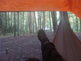
We passed a couple of great swimming holes and past Gragg Prong Falls fairly quickly and came to the campsite just 2 miles or so down the trail, where we found the rest of our group lounging in hammocks. They made it to camp just in time to beat the rain and were enjoying the somewhat clearer evening sky.
It stayed damp but rain-free the rest of the night and we enjoyed a fire and dinner before calling it a night.
Morning came with several options on how to spend the day. With several swimming holes and waterfalls, miles of trail, and the simple pleasure of spending the day in a hammock net to a creek; there was really no bad option to choose.

We had a somewhat slow morning making coffee and breakfast, then started the day with a nice day hike. We back tracked about a quarter mile to Timber Ridge trail and assented West. Although quite steep, it was a fairly easy trail that made for a great hike. We came to a fork in the trail and split up. Most of the group took the fork South to Hunt-Fish Falls (near our campsite) bu tJon and I decided to continue on the 6 mile loop.

We wanted to make it back in time do do some swimming so we were mindful to keep up our speed. Timber Ridge reaches its high point at Bee Mountain and then quickly descends to Lost Cove Creek. There is a good spring not too far past Bee Mountain where Jon and I stopped to fill our bottles. The trail descends through a nice stint on hardwoods before coming to Lost Cove Creek.

To continue the loop we took Lost cove trail back towards our camp site. Several really nice campsites were along the trail. As we approached Hunt-Fish Falls we started hearing thunder. We made it to camp and packed up our gear right before the rain started. We waited out the rain under a tarp. The rain didn't last long and we started back up Lost Cove trail towards our cars.
The creek was much clearer than the previous day and the creek crossings were manageable without getting to wet.
We stopped for a much anticipated swim at Gragg Prong Falls. Several small but deep pools create great spots to jump in and a larger pool at the bottom makes a great swimming hole.
After about an hour of swimming we headed back to our cars. We made the brilliant decision to stop in Boone at Capone's Pizza then headed back to Greensboro.


